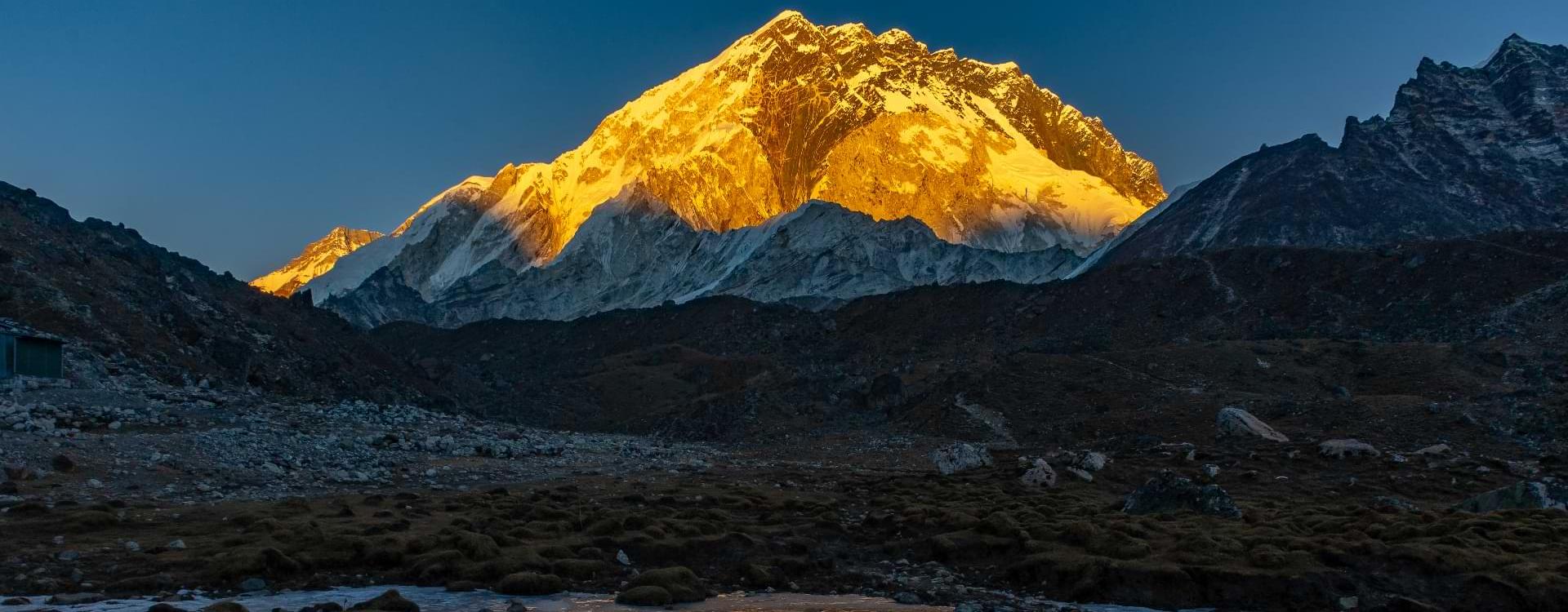
| Where is the Mount Everest? If you are already here, you might be looking for the location of the world's tallest mountain, Mount Everest. |
Mount Everest, known as ‘’सगरमाथा’’ in Nepali, ‘’Chomolungma’’ in Tibetan, and ‘’珠穆朗玛峰’’ in Chinese, stands high as the tallest mountain in the World above sea level. Mount Everest is situated in the mesmerizing Mahalangur Himal sub-range of the Himalayas, with the China-Nepal border gracefully running across its summit point.
Its precise location is defined by the latitude of 27.986065 and the longitude of 86.922623. The coordinates of Mount Everest in Nepal are 27°59′17″N, 86°55′31″E. These precise measurements pinpoint the exact position of this iconic mountain in the region, offering a sense of its remarkable geographical presence.
In 2020, the Chinese and Nepalese authorities established its elevation at 8,848.86 m, solidifying its position at the world's top. An Irresistible attraction for adventurers and Climbers, Mount Everest influences a magnetic pull on countless climbers, attracting both seasoned mountaineers and aspiring explorers.
The mountain offers two primary climbing routes, each with its unique enchantment. The first, commonly called the "standard route," approaches the summit from southeast Nepal. The second route originates from the north of Tibet.
While the standard route doesn't pose significant technical climbing challenges, Everest remains a formidable adversary due to the perils of altitude sickness, wintry weather, treacherous winds, avalanches, and the faithless Khumbu Icefall.
Tragically, as of November 2022, 310 individuals have died on Mount Everest. Over 200 bodies remain on Everest, unable to be retrieved due to unsafe conditions. Tracing the Steps of Pioneering British Mountaineers, the initial attempts to conquer Everest's summit were undertaken by British mountaineers. At that time, Nepal restricted entry to foreigners, prompting the British to make several endeavors along the North Ridge route from the Tibetan side.
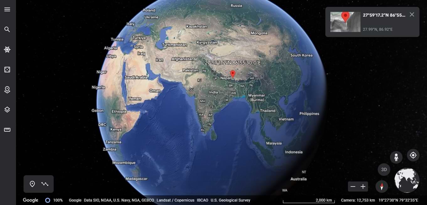
Mount Everest location on Global Map
If you already know Mount Everest coordinates, you can use them to search for that location:
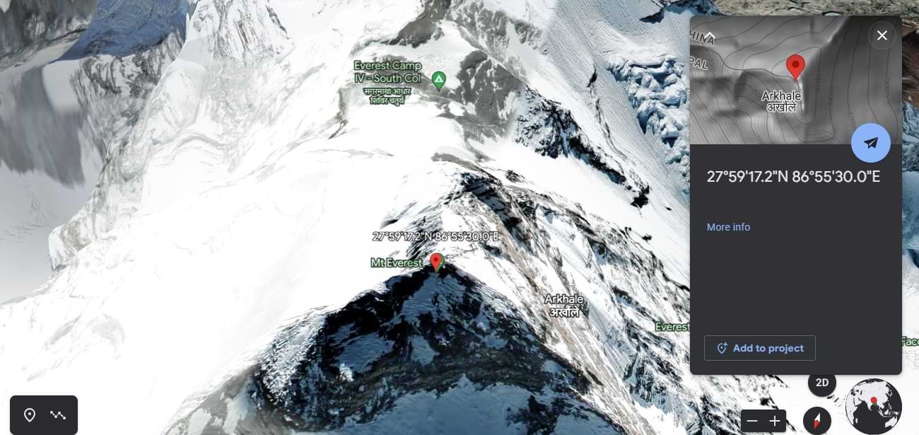
Mount Everest coordinates
Names of Mount Everest
Mount Everest, known as Qomolangma in Tibetan, is important in the hearts of mountaineers and adventure enthusiasts worldwide. The origins of its name can be traced back to the 18th century when it appeared as Tchoumour Lancma on a map published in Paris by the French geographer D'Anville. This majestic peak was also recorded with a Chinese transcription as "珠穆朗玛峰" during the reign of Emperor Kangxi of Qing China. Let us embark on a journey to discover this awe-inspiring mountain's fascinating history and unique names.
The Tibetan people hold Mount Everest in great reverence, referring to it as Qomolangma, which translates to "Holy Mother" in English. This sacred name captures the spiritual significance of the mountain in Tibetan culture. The Tibetan name is also commonly romanized as Chomolungma and written as Jo-mo-glang-ma in the Wylie transcription system.
British surveyors ventured into the Himalayan region in 1949. They sought to preserve local names whenever possible. Nevertheless, the quest for a widely adopted local appellation for Mount Everest posed significant challenges due to the limitations imposed by Nepal and Tibet on foreign entry into the region. Consequently, Andrew Waugh, the British Surveyor General of India, proposed that Peak XV be named after his predecessor, Sir George Everest, who had held the same position.
In the early 1960s, the Nepali government bestowed the mountain with a local name to honor its significance. They coined the Nepali name "Sagarmāthā" (सगरमाथा]), which translates to "the Head in the Great Blue Sky." This name symbolizes the mountain's majestic presence, rising high and touching the heavens. Derived from the words सगर (sagar), meaning "sky," and माथा (māthā), meaning "head," Sagarmāthā encapsulates the deep spiritual and cultural connections Nepali people have with the mountain.
1. Unveiling the world's highest mountains
In the early 19th century, the British embarked on a monumental endeavor known as the Great Trigonometrical Survey of India. Their mission was to precisely determine the locations, elevations, and names of the world's highest mountains. Equipped with massive theodolites, each weighing 500 kg (1,100 lb) and requiring 12 men to carry, the survey teams started their journey from southern India, gradually progressing northward.
By the 1830s, they had reached the foothills of the majestic Himalayas, but their progress could have been improved as Nepal, skeptical of their motives, denied them entry into the country. The British persevered, Despite several failed requests to enter Nepal.
2. Detailed Observations and Enigmatic Peaks
In 1847, the British resumed their survey, meticulously observing the Himalayan peaks from observation stations as far as 240 km (150 mi) away. The weather limited their work to the final three months of the year. In November 1847, Andrew Scott Waugh, the British Surveyor General of India, made significant observations from the Sawajpore station at the eastern end of the Himalayas.
At that time, Kangchenjunga was believed to be the highest peak in the world. However, Waugh noticed another peak beyond Kangchenjunga, approximately 230 km (140 mi) away. One of Waugh's subordinates, John Armstrong, also spotted the peak from a more westerly location and designated it as peak "b." Waugh suspected that peak "b" might surpass Kangchenjunga in height but acknowledged that closer observations were necessary to confirm this discovery.
In the subsequent year, Waugh dispatched a survey official back to Terai to conduct closer observations of peak "b," but unfortunately, his efforts were thwarted by persistent clouds.
In 1849, James Nicolson, sent by Waugh, conducted detailed observations from Jirol, located 190 km (120 mi) away. Carrying the largest theodolite, Nicolson journeyed eastward and obtained over 30 observations from five different sites, with the closest observation point situated 174 km (108 mi) from the peak.
Nicolson returned to Patna on the banks of the Ganges to perform the necessary calculations based on his observations. The raw data indicated an average height of 9,200 m (30,200 ft) for peak "b." However, these calculations did not account for light refraction, which can distort height measurements. Nonetheless, it was evident that peak "b" surpassed Kangchenjunga in elevation. Unfortunately, Nicolson fell ill with malaria and had to abandon his calculations. One of Waugh's assistants, Michael Hennessy, had begun assigning Roman numerals to peaks with Kangchenjunga.
Mount Everest, the majestic peak that pierces the sky, holds a wealth of knowledge about our planet's past within its geological layers. Geologists have meticulously studied and classified the rocks of Mount Everest, dividing them into three distinct units known as formations. These formations, separated by fault lines, reveal a fascinating story of tectonic forces and ancient marine environments. Let's delve into Mount Everest's geological wonders and uncover the hidden secrets.
Within the Qomolangma Formation, geologists have discovered microscopic fragments of crinoids, showcasing the remnants of ancient marine life. Petrographic analysis has revealed the presence of carbonate pellets and finely fragmented remains of trilobites, crinoids, and ostracods within the limestone samples. However, some samples have undergone significant deformation and recrystallization, making it challenging to identify their original constituents. Notably, a remarkable 60-meter (200-foot) thick thrombolite bed, composed of sediment trapped and cemented by micro-organisms, including cyanobacteria, marks the base of the "Third Step" and the summit pyramid of Everest.
The Qomolangma Formation is dissected by several high-angle faults that ultimately converge at the low-angle normal fault, the Qomolangma Detachment. This detachment distinguishes the Qomolangma Formation from the underlying Yellow Band, with the lower five meters displaying intense deformation.
Examination of marble samples collected at approximately 8,300 meters (27,200 feet) has unveiled the presence of recrystallized crinoid ossicles, accounting for up to five percent of the composition. Adjacent to the Qomolangma Detachment, the uppermost five meters of the Yellow Band has undergone considerable deformation. A fault breccia measuring 5-40 centimeters (2.0-15.7 inches) in thickness separates the Yellow Band from the overlying Qomolangma Formation.
Further descending between 7,000 and 8,200 meters (23,000 and 26,900 feet), we encounter interlayered and deformed schist, phyllite, and minor marble, constituting the remaining portion of the North Col Formation. Within this range, the North Col Formation primarily consists of biotite-quartz phyllite and chlorite-biotite phyllite, interspersed with minor amounts of biotite-sericite-quartz schist. Between 7,000 and 7,600 meters (23,000 and 24,900 feet), the lower section of the North Col Formation displays biotite-quartz schist intercalated with epidote-quartz schist, biotite-calcite-quartz schist, and thin layers of quartzose marble.
These metamorphic rocks are believed to have formed through the alteration and metamorphism of Middle to Early Cambrian deep-sea flysch. The flysch consisted of interbedded mudstone, shale, clayey sandstone, calcareous sandstone, graywacke, and sandy limestone. The base of the North Col Formation is marked by the presence of a regional low-angle normal fault known as the "Lhotse detachment."
Beneath the North Col Formation lies the Rongbuk Formation, forming the bedrock of Mount Everest. This formation comprises sillimanite-K-feldspar grade schist and gneiss, penetrated by numerous sills and dikes of leucogranite, ranging from a mere centimeter to an astounding 1,500 meters (0.4 inches to 4,900 feet) in thickness.
These leucogranites belong to the Higher Himalayan leucogranite belt, a collection of Late Oligocene-Miocene intrusive rocks. They originated from the partial melting of Paleoproterozoic to Ordovician high-grade metasedimentary rocks within the Higher Himalayan Sequence, occurring approximately 20 to 24 million years ago during the subduction of the Indian Plate.
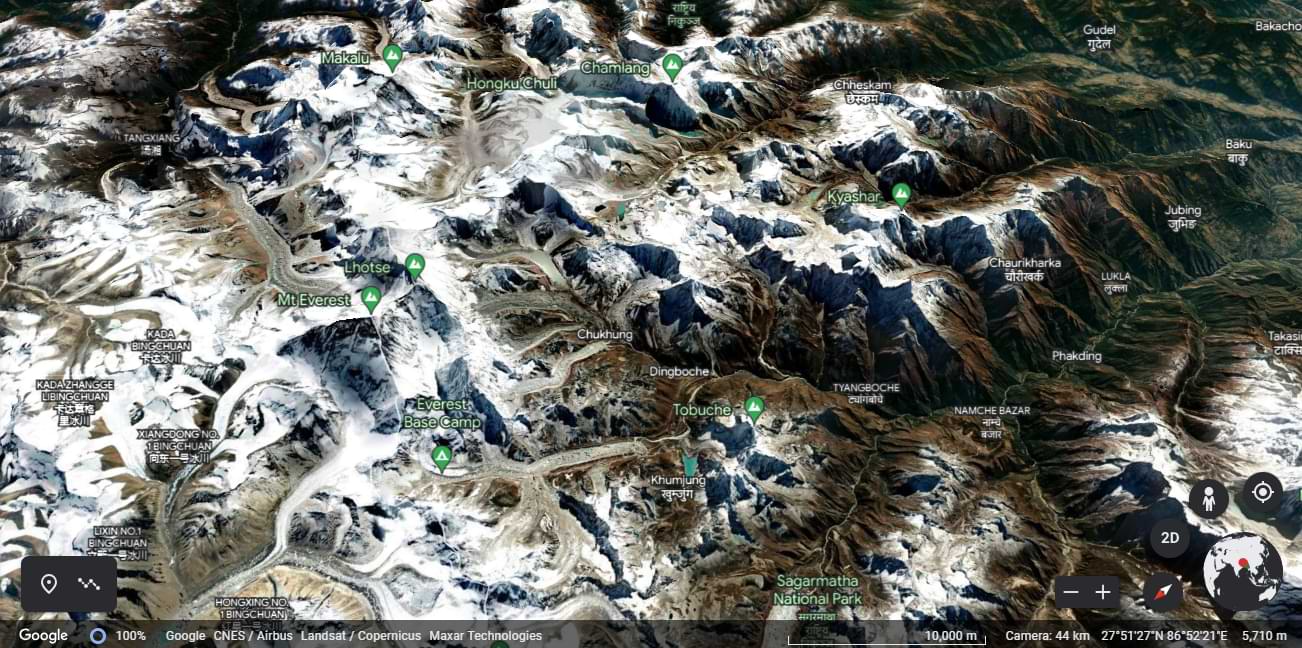
Mount Everest on Google Earth
Mount Everest presents a challenging environment for plant and animal life. However, despite the inhospitable nature of the mountain, there are remarkable instances of flora and fauna that have adapted to survive in this extraordinary ecosystem.
Despite the harsh conditions, some fascinating plant species have adapted to survive in Everest's thin air and frigid temperatures. One such example is a moss that grows remarkably at a great altitude of 6480 meters (21260 ft), possibly making it the highest-altitude plant species discovered thus far. Additionally, an alpine cushion plant known as Arenaria has been found to flourish below 5500 meters (18000 ft) in the Everest region.
Recent studies based on satellite data from 1993 to 2018 have shed light on the expansion of vegetation in the Everest region. Surprisingly, researchers have discovered plants in areas that were previously thought to be barren, revealing the resilience of nature even in the harshest of environments.
Mount Everest is not just home to unique flora; it also harbors extraordinary fauna, some of which have adapted to survive at astonishing heights. Meet Euophrys omnisuperstes, a tiny black jumping spider that has been found as high as 6700 meters (22000 ft). This incredible creature could be considered the highest non-microscopic permanent resident on Earth if confirmed. Additionally, the jumping spider Euophrys everestensis can be found in Everest's base camp, seeking refuge in crevices and sustaining itself on frozen insects carried by the wind. Notably, there is a strong possibility of microscopic life even at greater altitudes.
Standing tall in its ice cap climate, Mount Everest experiences freezing temperatures all year round, making it a harsh and unforgiving environment. Let's delve into the fascinating climate data and meteorological challenges climbers face in this iconic region.
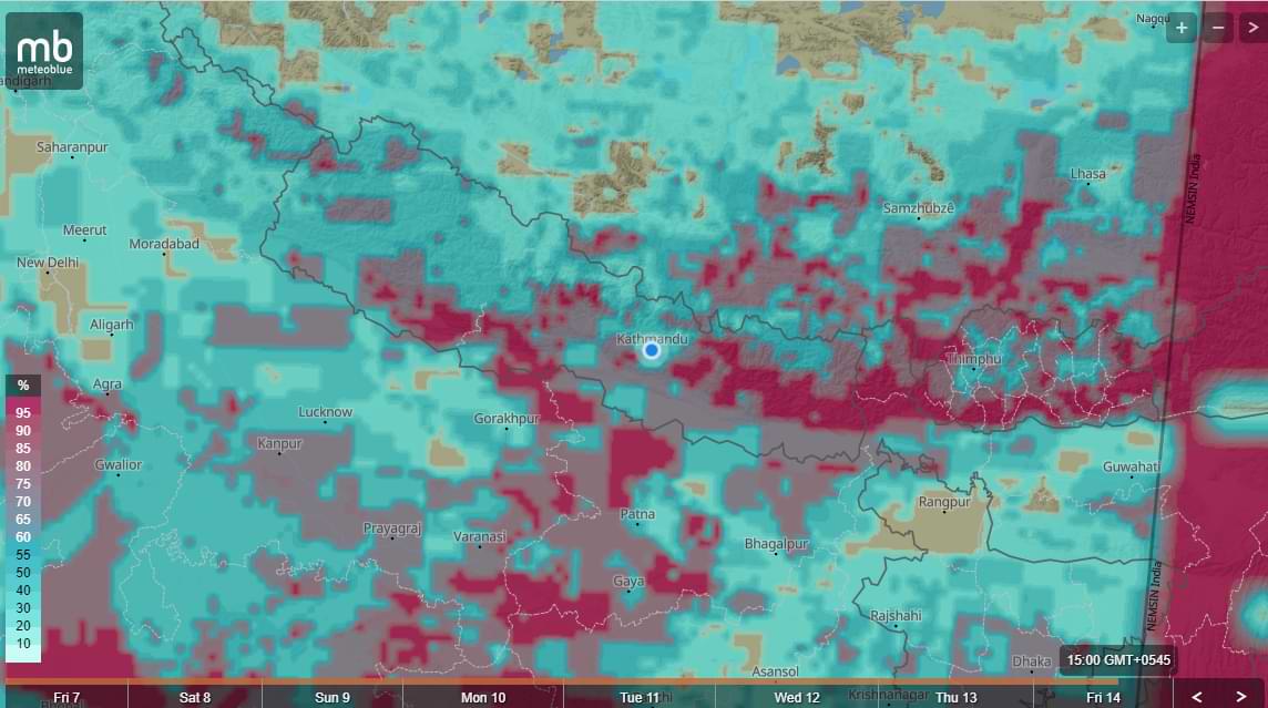
Precipitation probability on Mount Everest during monsoon season
The climate data for Mount Everest reveals the extreme cold experienced throughout the year. The mean minimum temperatures in degrees Celsius for each month are as follows:
| Month | January | February | March | April | May | June | July | August | Sept | October | November | December |
| Average Temperatures | -36°C | -35°C | -32°C | -31°C | -25°C | -20°C | -18°C | -18°C | -21°C | -27°C | -30°C | -34°C |
The data shows that temperatures consistently average well below freezing, making this region a challenging and perilous environment for climbers and researchers alike.
The impact of climate change on Mount Everest is undeniable, and it is causing significant concerns for climbers and the ecosystem. The Khumbu Glacier, where the base camp for Everest expeditions is located, is rapidly thinning and becoming unstable due to climate change. This worrying trend has rendered the current base camp unsafe for climbers, leading to discussions on relocating it to a lower altitude.
Nepal's government has addressed this issue and formed a committee to monitor mountaineering activities in the Everest region. As a response, they plan to move the base camp to a safer location, even though it would mean longer distances for climbers between the base camp and Camp 1. The existing base camp, however, is expected to remain operational for another three to four years before the proposed move takes place, which is slated to happen by 2024.

cloud and precipitation on Mount Everest during the monsoon season
Mount Everest poses unique meteorological challenges, which have greatly interested researchers. The region's high elevation allows it to extend into the upper troposphere and even penetrate the stratosphere. The air pressure at the summit is approximately one-third of what it is at sea level, resulting in thin air and reduced oxygen levels.
Strong and freezing winds from the jet stream add to the harsh conditions. Winds on Everest can reach speeds of up to 160 km/h (100 mph), with recorded gusts of 280 km/h (175 mph). These powerful winds create hazards for climbers, such as blowing them into chasms and lowering the air pressure further, reducing available oxygen by up to 14 percent.
To mitigate the risks posed by these extreme meteorological conditions, climbers typically aim for specific windows during the spring and fall when the Asian monsoon season is transitioning. This strategic approach allows them to avoid the harshest winds and increase their chances of a successful ascent.
In 2008, a significant milestone was achieved by installing a new weather station at an elevation of approximately 8,000 meters (26,000 ft). This weather station, orchestrated by Stations at High Altitude for Research on the Environment (SHARE), provides invaluable data on various meteorological parameters, including air temperature, relative humidity, atmospheric pressure, wind speed, direction, and solar radiation.
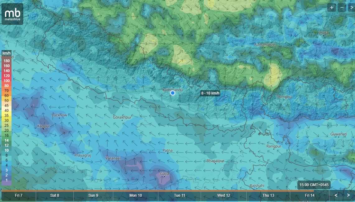
wind probability on Mount Everest during the Monsoon season
Annual Climbing Permit
The number of climbing permits issued by Nepal varies each year, reflecting the popularity and demand for Everest expeditions. Here is a breakdown of permit issuance over the years:
| Year | Permit Issued |
| 2008 | 160 |
| 2009 | 220 |
| 2010 | 209 |
| 2011 | 225 |
| 2012 | 208 |
| 2013 | 316 |
| 2014 | 326 |
| 2015 | 356 |
| 2016 | 289 |
| 2017 | 373 |
| 2018 | 346 |
| 2019 | 381 |
| 2020 | 0 (no permits issued due to the COVID-19 pandemic) |
| 2021 | 408 |
| 2022 | 425 |
| 2023 | 454 |
Mount Everest features two primary climbing routes: the southeast ridge from Nepal and the north ridge from Tibet. While several lesser-used routes exist, these two are the most frequently chosen options. The southeast ridge, used by Edmund Hillary and Tenzing Norgay in their historic 1953 ascent, is technically easier and more commonly traversed. This route gained prominence for political reasons, as the Chinese border was closed to the Western world during the 1950s when the People's Republic of China invaded Tibet.
5 Most Popular Treks In the Everest Region
The Everest Base Camp trek on the south side offers an extraordinary adventure that captivates countless enthusiasts in the mesmerizing Himalayas. Situated at a breathtaking elevation of 5,364 meters (17,598 feet), this trekking route has gained immense popularity among adventurers worldwide. Annually, approximately 40,000 individuals embark on this remarkable journey, commencing from Lukla Airport (2,846 meters/9,337 feet).
It allows adventurers to challenge themselves physically and mentally while immersing in the magnificence of the Himalayas. Whether you choose to fly from Kathmandu to Lukla or embark on the trekking route, the experience promises breathtaking views, cultural encounters, and a sense of accomplishment that will stay with you forever.
If you're pressed for time yet yearn to experience the grandeur of Mt. Everest in the Everest region, look no further than our exceptional Everest View Trek. This trek presents the perfect opportunity for those with limited time in Nepal to embark on a remarkable journey to the renowned Everest Base Camp. Immerse yourself in the captivating allure of the Khumbu region as you traverse through the vibrant town of Namche Bazaar.
The Everest View Trek offers unparalleled glimpses of the world's highest peaks, including the mighty Mt. Everest itself. Stand in awe as you witness the grandeur of Everest, Lhotse, Nuptse, Ama Dablam, and numerous other snow-capped giants dominating the horizon. Each step brings you closer to nature's masterpiece, leaving an indelible mark on your soul.
The Gokyo Lake Trek presents a captivating alternative to the traditional Everest Base Camp trek, allowing trekkers to revel in breathtaking views of Mt. Everest while immersing themselves in the iconic town of Namche Bazaar, the gateway to the Khumbu Region. This less crowded route offers a unique perspective on local village life, showcasing the magnificence of icy rivers, rugged glacier debris, majestic snow-capped mountains, and the mesmerizing turquoise waters of the Gokyo Lakes. Comprising six stunning lakes situated at an elevation of 4700 to 5000m in the Gokyo Valley, these new bodies of water are the world's highest freshwater lake system. Designated as a Ramsar site of international importance, the Gokyo Lakes are revered by both Hindus and Buddhists. Renowned travel guide Lonely Planet hails the Gokyo Valley as the most spectacular in the entire Khumbu region, underscoring its undeniable beauty and significance.
For those seeking an extended and exhilarating version of the iconic Everest Base Camp Trek, the Everest Chola Pass Trek presents an extraordinary opportunity to venture into the challenging terrain of the Nepalese Himalayas. This fully-fledged adventure promises to take you to new heights as you traverse the formidable Chola Pass (5,420m), offering breathtaking views of the legendary Mount Everest.
Along the way, immerse yourself in the rich Sherpa culture and witness their resilient way of life amidst the awe-inspiring Himalayan landscapes. The Everest Chola Pass Trek also showcases the enchanting valleys of Gokyo, where magnificent mountains, vast glaciers, and the sacred Gokyo Lakes await you at every turn.
Prepare yourself for an unparalleled trekking experience as you embark on the Everest Chola Pass Trek. This journey takes you beyond the conventional trails, immersing you in the raw beauty of the Himalayas. With each step, you'll encounter the thrill of conquering the formidable Chola Pass, standing proudly at an elevation of 5,420m. As you ascend, be rewarded with awe-inspiring panoramic views of the majestic Mount Everest, an experience that will leave an indelible mark on your soul.
Nestled within the majestic Everest Region and encompassed by the breathtaking Sagarmatha National Park, the Three Passes Trek in Nepal offers fellow trekkers a thrilling expedition across three high mountain passes: Kongma La (18,209 ft / 5,550 m), Cho La (17,782 ft / 5,420 m), and Renjo La (17,560 ft / 5,360 m). It is from this incredible feat that the trek derives its name.
This exhilarating flat loop trek can be initiated from Lukla. This famed mountain airport leaves visitors in awe of other starting points, such as Jiri, Shivalaya, Salleri, or Phaplu.
The Three Passes Trek is a remarkable feat that will test your physical endurance and mental resilience. With each pass you conquer—Kongma La, Cho La, and Renjo La—you'll be rewarded with awe-inspiring vistas of the surrounding mountains, glaciers, and valleys. These high-altitude crossings provide an opportunity to witness the raw power of nature while challenging yourself amidst the dramatic backdrop of the Himalayas.